Sea Ice
Sea ice forms at the surface of seawater when it freezes. Due to the salinity of seawater, it has a lower freezing point than freshwater (approximately -1.8°C, or 28.8°F). Unlike icebergs, which originate from ice formed on land, sea ice forms and melts entirely in the ocean.
概述
Sea ice can be classified based on many factors such as age, thickness, and form. The two primary age categories are “first-year” ice, which has existed for less than a single annual melt cycle, and “multi-year” ice, which has survived one or more melt cycles. Other examples of common sea-ice categories include new ice (recently-formed ice, including frazil, grease ice, slush and shuga), nilas (a thin elastic crust, <10 cm thick), pancake ice (predominantly circular pieces of ice between 30 cm and 3 m in diameter), young ice (ice in the transition stage between nilas and first-year ice, 10-30 cm thick), fast ice (sea ice attached to the shore or ocean floor) and drift ice (sea ice unattached to the shore or ocean floor) (WMO, 2014).

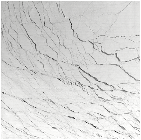
Features such as melt ponds, polynyas (openings in the ice caused by winds or ocean temperature) and leads (channels created by ice dynamics) highlight the complex nature of sea ice. Pressure-induced formations like ridges (formed when sea ice piles up due to winds and ocean currents) and hummocks (ridges that have been smoothed by erosion) further characterize this dynamic environment.
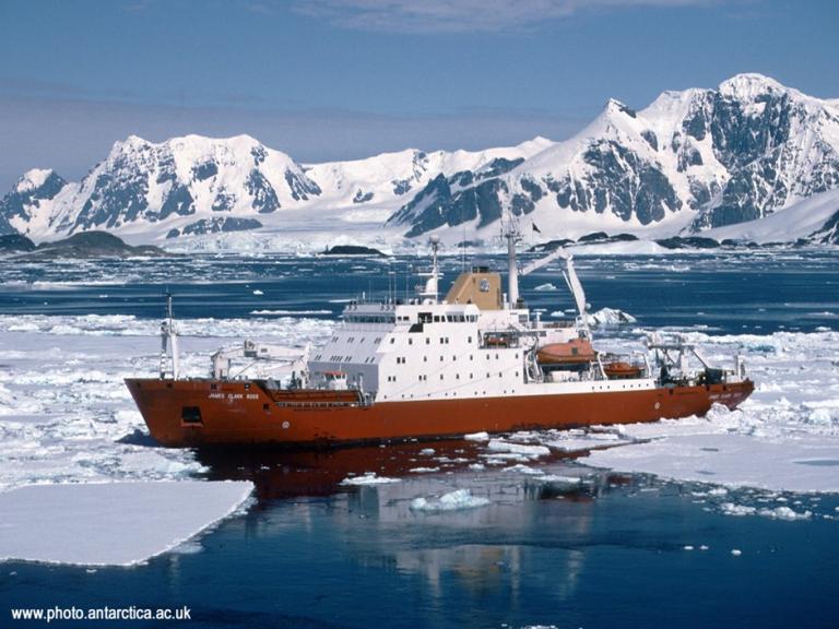
Sea ice is a prominent feature in polar regions and can be observed across vast areas of the Arctic and Antarctic through satellite imagery. These frozen expanses are integral to understanding Earth’s weather, climate, and ocean systems.
影响
Sea ice is a critical component of the Earth’s climate system, influencing surface heat, moisture, radiation, and freshwater fluxes. Acting as a “thermal blanket,” it limits heat and moisture exchange between the ocean and atmosphere. Its reflective surface (albedo) reduces heat absorption, which moderates warming. A reduction in sea ice extent therefore amplifies warming effects in high latitudes. Sea ice variability is a key indicator of climate variability and change in the polar regions.
Sea ice also redistributes salt and freshwater. During freezing, brine rejection increases water salinity, contributing to the formation of dense, cold water in regions such as the North Atlantic and Antarctica. This process supports global ocean circulation and climate regulation.
The seasonal sea-ice zone is highly productive biologically, which makes sea ice a key component of the carbon cycle. Fast ice provides an important habitat for wildlife, and the shear zone between fast and drifting ice provides vital open-water areas that benefit Arctic and Antarctic ecosystems.
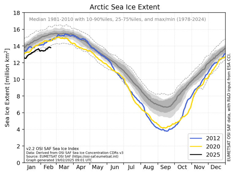
Recent trends reveal significant changes in sea ice extent. The Arctic has experienced a sharp decline (an estimated average reduction of 12.8% per decade between 1981 and 2010 in September sea ice extent) while no significant trends have been found in the Antarctic (IPCC, 2019). Projections suggest that Arctic sea ice could become seasonal in the coming decades, profoundly affecting ecosystems, residents, and global climate systems.
世界气象组织的回应
The WMO supports monitoring and research initiatives to understand sea ice trends and their implications. Collaborative projects utilize satellite imagery and sea ice models, such as PIOMAS, to track changes in volume and extent. These efforts are essential for assessing the role of sea ice in the climate system and predicting its future behavior. Sea ice monitoring also contributes to broader cryosphere research, which integrates observations of snow, glaciers, permafrost, and lake and river ice to provide a comprehensive understanding of Earth’s frozen regions.
In 2022, the WMO published the first globally coordinated guide to the Measurement of Key Sea Ice Variables, within the WMO Guide to Instruments and methods of Observation (WMO No 8, Volume II), available in its six official languages. It provides an extensive assessment of current practices on monitoring and reporting glacier data, and it supports the definition of standards for data reporting.
The Global Climate Observing System (GCOS), co-sponsored by the WMO, the Intergovernmental Oceanographic Commission of the United Nations Educational, Scientific and Cultural Organization (IOC-UNESCO), the United Nations Environment Programme (UN Environment) and the International Science Council (ISC), has defined a set of key variables that are considered essential for monitoring sea ice, known as Essential Climate Variables (ECVs). By defining and continually updating these ECVs (Lavergne et al., 2022), GCOS supports the collection of consistent, comprehensive and standardized sea ice data.
Since 1981, the WMO has been releasing guides that offer information on the methods for acquiring, analyzing, and sharing sea-ice data, as well as on global sea-ice services, to support safe and efficient operations in polar regions. The latest of these publications, WMO-No. 574: Sea-ice Information and Services, was released in 2024.
The WMO provides standardized terminology, symbology and definitions for sea ice in WMO-No. 259: Sea Ice Nomenclature to ensure consistent and accurate communication among scientists and professionals working in polar regions, thereby enhancing the understanding, analysis, modeling and reporting of sea-ice conditions.
The Global Cryosphere Watch (GCW) provides reliable, up-to-date information and assessments on sea conditions and trends worldwide, through resources such as the GCW Sea Ice Tracker tools and the GCW Sea Ice Assessments.